SOFTWARE


X6 Suite 3D - Work Smart, Not Hard.
The X6 Suite® , is an advanced Ground Scanning in 3D, for the detection and precise localization of anomalies in the ground. In addition, it is perfectly suited for detecting and locating underground cavities such as bunkers, graves or tunnels.
Many innovative technical features have been added and developed to this new device:
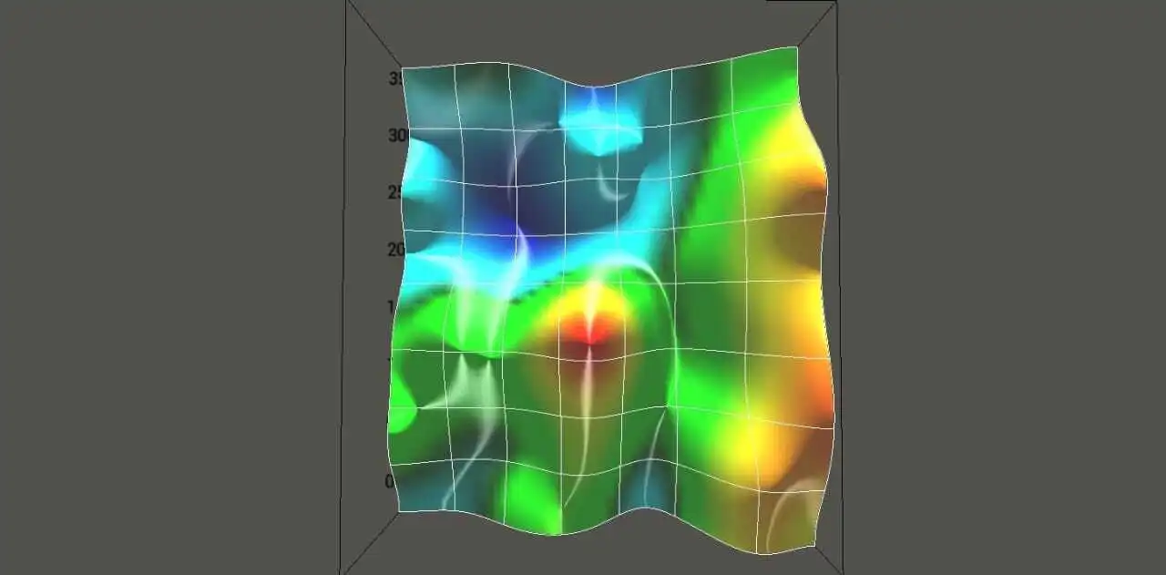
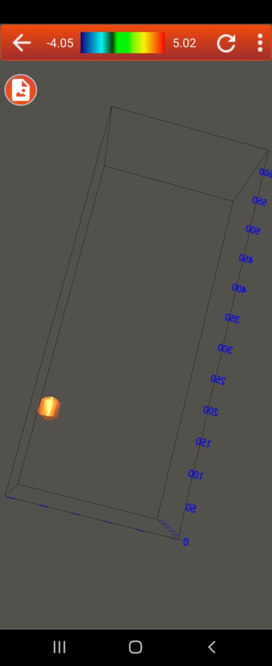
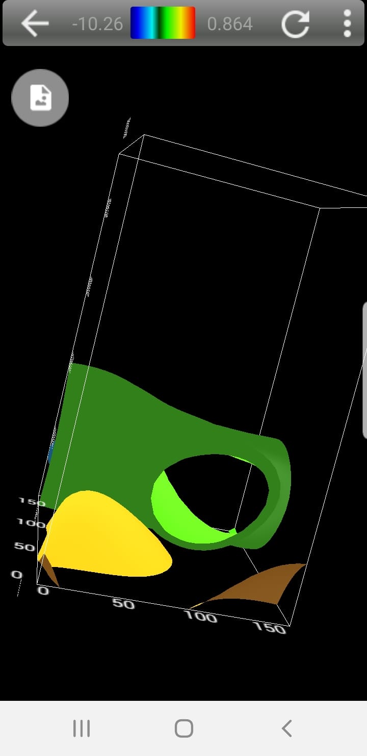
Scanning all the ground layers and showing image from 3 different directions on the screen of the device. Full results to illustrate the target underground from 3 directions, from the side, the bottom and top, to clarify and show everything like gold, metals, buried treasures, caves, spaces, voids, and graves. It shows the depth of all undiscovered targets in centimetres, the device software shows the beginning and end of the target depth.
Advanced Ground Scanning in 3D!
In addition to the 3D visualization of the detected treasure finds and the measurement of the depth, position and size of the find objects, the innovative analysis software, the position, size and depth of the detected object can be determined more precisely after the measurement with the X6 Plus detector.
Eliminate subsurface uncertainty. Achieve insight and clarity by transforming raw, subsurface data into understandable well logs and cross sections.
Easily create professional geotechnical reports that clearly communicate important information with X6 Pro Suite.
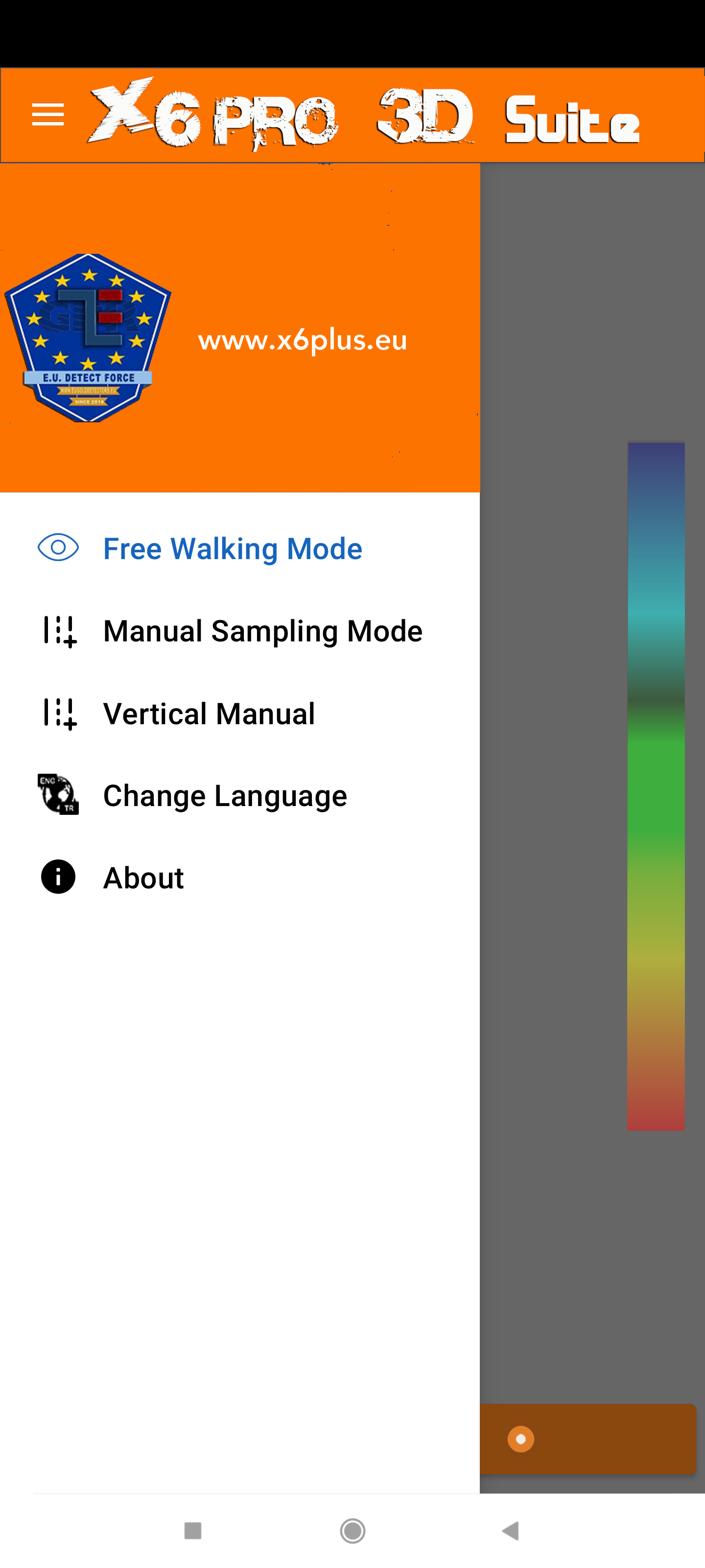
3D software developed by our engineers that offers a detailed analysis of the scanned area.
You can scan automatically or manually (you add the number of rows and their lengths) and choose zigzag area scans.
The results appear on the tablet, you can then determine which king of target you encounter whether it’s a void or metal. You can even see if it’s rock, iron, gold, diamond etc.
- Automatic creation of a three-dimensional representation of the recorded measurement data after importing the raw data from the detector.
- Determination of position, size and depth of the detected objects, before excavation.
- Add supplementary notes to specific measurement.
Once tuned, software will automatically adjust to mineralization level. Therefore even treasure hunters that have never tested a professional detector can easily use our devices. Just enter the dimension of the area you want to scan and start analysing what’s below your feet. Save scans in the memory and later transfer them to your computer and use 3rd party software's such as Voxler ones.


X6 Pro Suite 3D
With X6 Plus Plotter 3D, model data with striking clarity in every dimension. With Plotter’s extensive 3D modeling tools, it is easy to 3D visualize multi-component data for geologic models, borehole models, or body deposit models.
The innovative visualization software offers users a wide range of options, both in processing and in displaying and evaluating the scan data.
Distinguish areas of interest, highlight important information, and easily communicate your newfound knowledge to stakeholders in three dimensions.


- Features
- Supported devices
- Plotter languages
- Advanced Settings.
- Representation as 2D and 3D graphics.
- depth measurement.
- Adjust views (rotate, scale, move).
- Import scan data.
- data export as CSV for further processing in other software (e.g. Voxler).
- Large Area Scanning.
- Determination of the object position.
- Discrimination mode to distinguish precious metal, non-precious metal and cavity.
- Optimized live image.
- Variable grid display.
- Functions to improve the graphics (e.g. interpolation, colour filter).
- 360° rotatable 3D ground scans.
– X6 Plus® Graunding Radar
– X6 Plus® EMFEU
– X6 Plus® GPR
– X6 Plus® 3d GRS
- English.
- Chinese.
- Greek.
- Turkey .